46 posts tagged “leaflet”
The Leaflet JavaScript library for interactive maps.
2021
2020
Weeknotes: California Protected Areas in Datasette
This week I built a geospatial search engine for protected areas in California, shipped datasette-graphql 1.0 and started working towards the next milestone for Datasette Cloud.
[... 1,099 words]

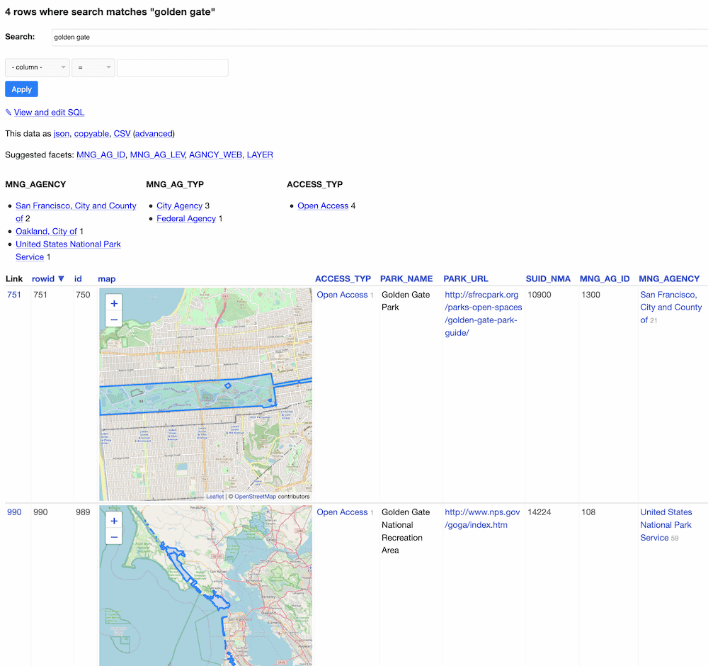
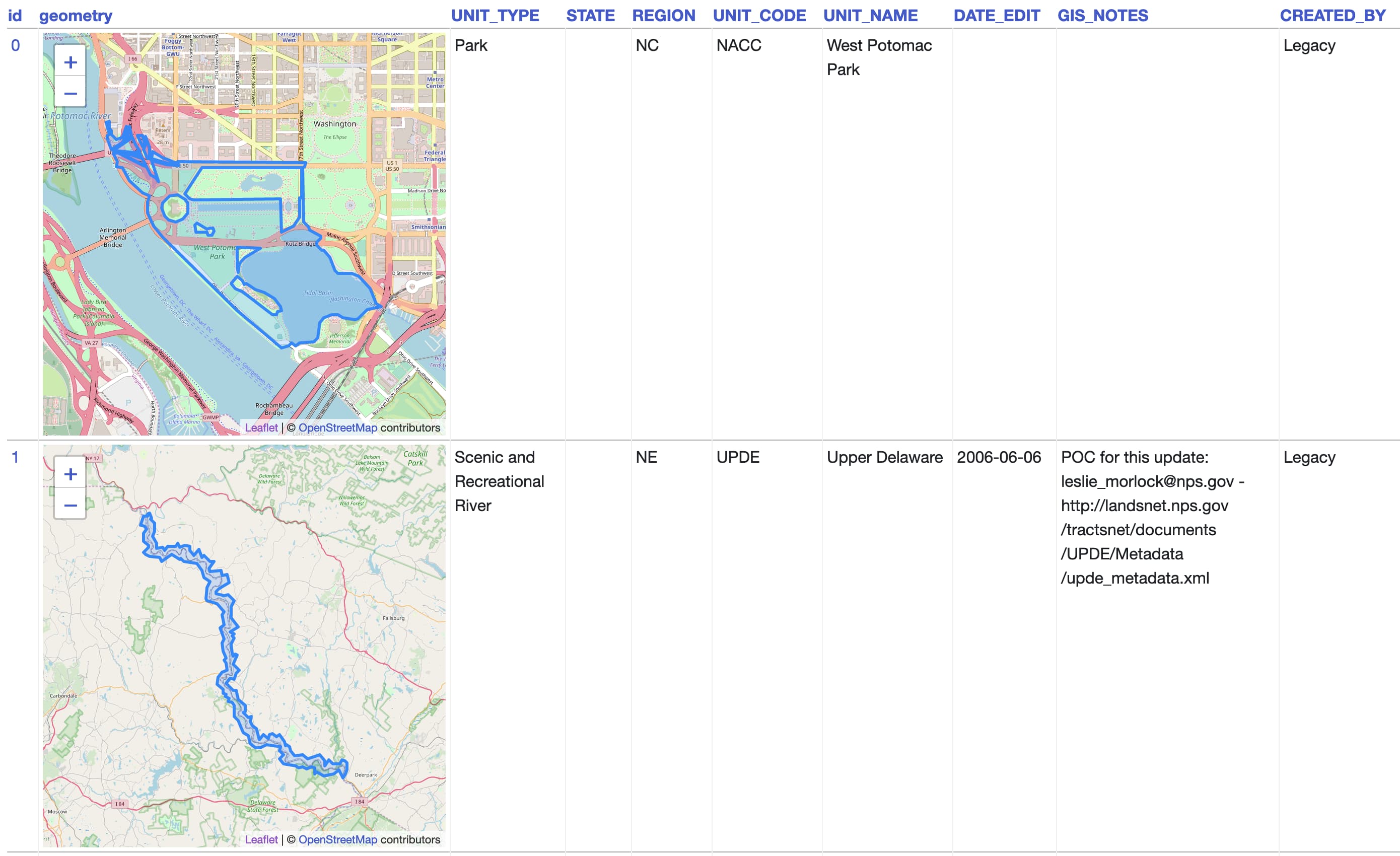
California Protected Areas Database in Datasette (via) I built this yesterday: it’s a Datasette interface on top of the CPAD 2020 GIS database of protected areas in California maintained by GreenInfo Network. This was a useful excuse to build a GitHub Actions flow that builds a SpatiaLite database using my shapefile-to-sqlite tool, and I fixed a few bugs in my datasette-leaflet-geojson plugin as well.
Things I learned about shapefiles building shapefile-to-sqlite
The latest in my series of x-to-sqlite tools is shapefile-to-sqlite. I learned a whole bunch of things about the ESRI shapefile format while building it.
[... 1,073 words]2019
Weeknotes: PG&E outages, and Open Source works!
My big focus this week was the PG&E outages project. I’m really pleased with how this turned out: the San Francisco Chronicle used data from it for their excellent PG&E outage interactive (mixing in data on wind conditions) and it earned a bunch of interest on Twitter and some discussion on Hacker News.
[... 452 words]2018
Datasette plugins, and building a clustered map visualization
Datasette now supports plugins!
[... 751 words]2017
Building a location to time zone API with SpatiaLite, OpenStreetMap and Datasette
Given a latitude and longitude, how can we tell what time zone that point lies within? Here’s how I built a simple JSON API to answer that question, using a combination of data from OpenStreetMap, the SpatiaLite extension for SQLite and my Datasette API tool.
[... 2,185 words]