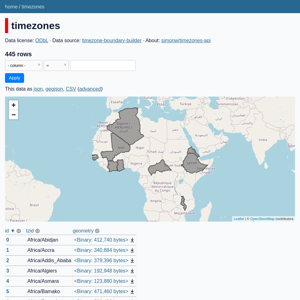
11 posts tagged “spatialite”
2023
TG: Polygon indexing (via) TG is a brand new geospatial library by Josh Baker, author of the Tile38 in-memory spatial server (kind of a geospatial Redis). TG is written in pure C and delivered as a single C file, reminiscent of the SQLite amalgamation.
TG looks really interesting. It implements almost the exact subset of geospatial functionality that I find most useful: point-in-polygon, intersect, WKT, WKB, and GeoJSON—all with no additional dependencies.
The most interesting thing about it is the way it handles indexing. In this documentation Josh describes two approaches he uses to speeding up point-in-polygon and intersection using a novel approach that goes beyond the usual RTree implementation.
I think this could make the basis of a really useful SQLite extension—a lighter-weight alternative to SpatiaLite.
Weeknotes: AI hacking and a SpatiaLite tutorial
Short weeknotes this time because the key things I worked on have already been covered here:
Datasette 0.64, with a warning about SpatiaLite
I release Datasette 0.64 this morning. This release is mainly a response to the realization that it’s not safe to run Datasette with the SpatiaLite extension loaded if that Datasette instance is configured to enable arbitrary SQL queries from untrusted users.
[... 675 words]2021
Spatialite Speed Test. Part of an excellent series of posts about SpatiaLite from 2012—here John C. Zastrow reports on running polygon intersection queries against a 1.9GB database file in 40 seconds without an index and 0.186 seconds using the SpatialIndex virtual table mechanism.
Drawing shapes on a map to query a SpatiaLite database (and other weeknotes)
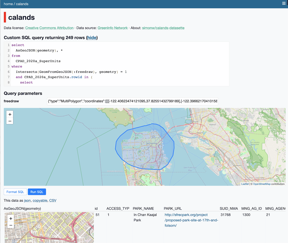
This week I built a Datasette plugin that lets you query a database by drawing shapes on a map!
[... 950 words]2020
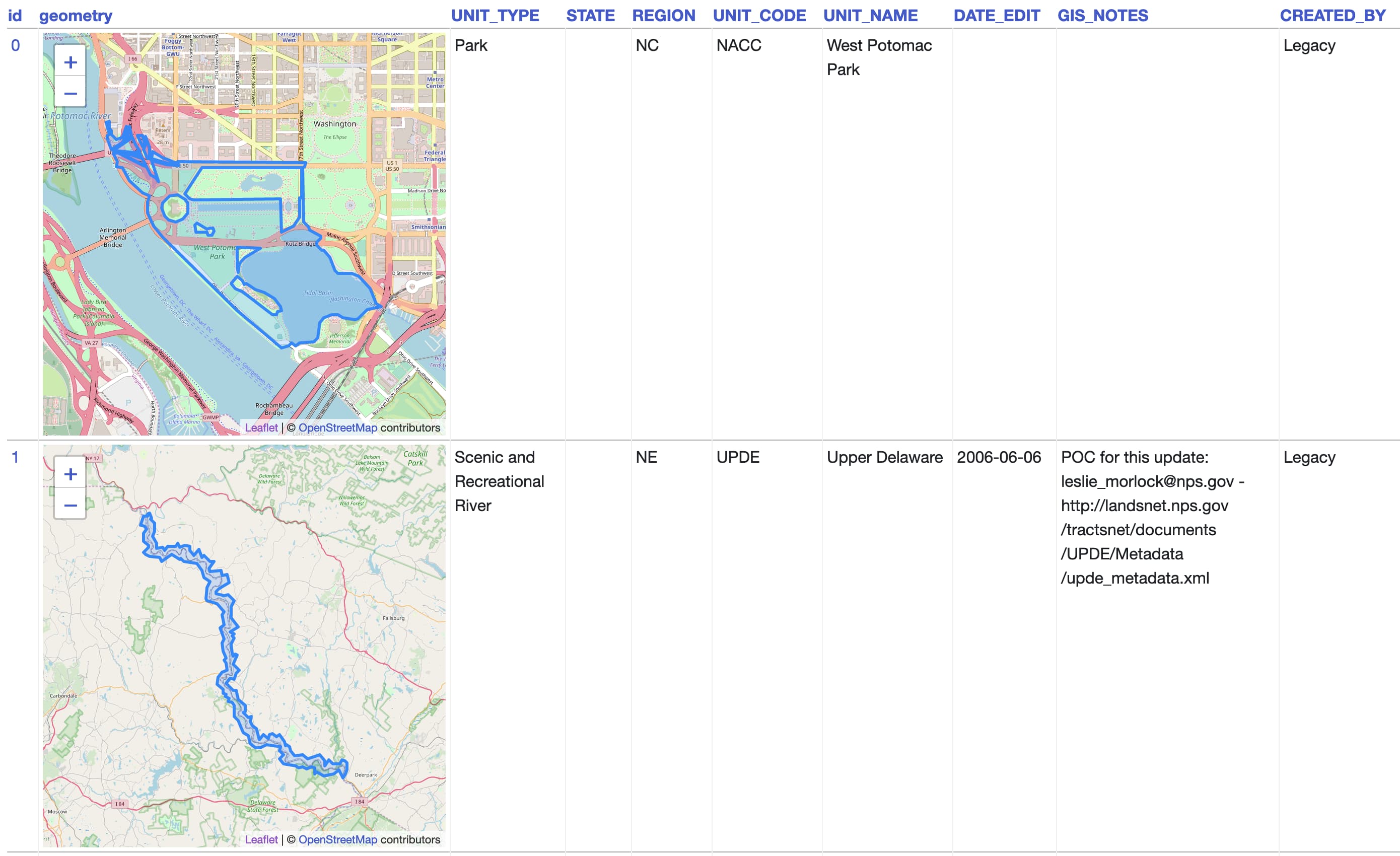
California Protected Areas Database in Datasette (via) I built this yesterday: it’s a Datasette interface on top of the CPAD 2020 GIS database of protected areas in California maintained by GreenInfo Network. This was a useful excuse to build a GitHub Actions flow that builds a SpatiaLite database using my shapefile-to-sqlite tool, and I fixed a few bugs in my datasette-leaflet-geojson plugin as well.
Things I learned about shapefiles building shapefile-to-sqlite
The latest in my series of x-to-sqlite tools is shapefile-to-sqlite. I learned a whole bunch of things about the ESRI shapefile format while building it.
[... 1,073 words]geojson-to-sqlite (via) I just put out the first release of geojson-to-sqlite—a CLI tool that can convert GeoJSON files (consisting of a Feature or a set of features in a FeatureCollection) into a table in a SQLite database. If you use the --spatialite option it will initalize the table with SpatiaLite and store the geometries in a spacially indexed geometry field—without that option it stores them as GeoJSON.
2018
SpatiaLite — Datasette documentation. Datasette’s documentation now includes extensive coverage of the SpatiaLite extension for SQLite: how to install it, how to import latitude/longitude points, shapefiles and GeoJSON data into SpatiaLite tables, and how to run SQL queries against it that take advantage of spatial indexes. I’m learning SpatiaLite at the moment and filling out the documentation with each new trick I learn as I go—as Mark Pilgrim once taught me, the best way to learn a new technology is to write about it.
VirtualKNN for SpatiaLite. This looks amazing: a special virtual table shipped as part of SpatiaLite 4.4.0 which implements a fast, R-Tree backed mechanism for finding the X nearest points against a geospatial database table. There’s just one catch: it’s only available in 4.4.0, but the most recent “stable” release of SpatiaLite is 4.3.0a from September 2015 so the version you get if you install from apt-get or homebrew doesn’t yet have this functionality. I’d love to figure out a neat way to package and distribute this along with Datasette. I’d also like to figure out a clean way to ship a more recent version of SQLite than the one that is currently packaged with Python 3 (3.16.2, where the latest SQLite release is 3.23.1).
2008
GeoCouch: Geospatial queries with CouchDB. Interesting approach: uses “external2”, a branch that allows external services to be called from CouchDB. SQLite’s SpatiaLite extension is then used as an external spacial index.