7 posts tagged “shapefiles”
2024
mapshaper.org (via) It turns out the mapshaper CLI tool for manipulating geospatial data—including converting shapefiles to GeoJSON and back again—also has a web UI that runs the conversions entirely in your browser. If you need to convert between those (and other) formats it’s hard to imagine a more convenient option.
Claude and ChatGPT for ad-hoc sidequests
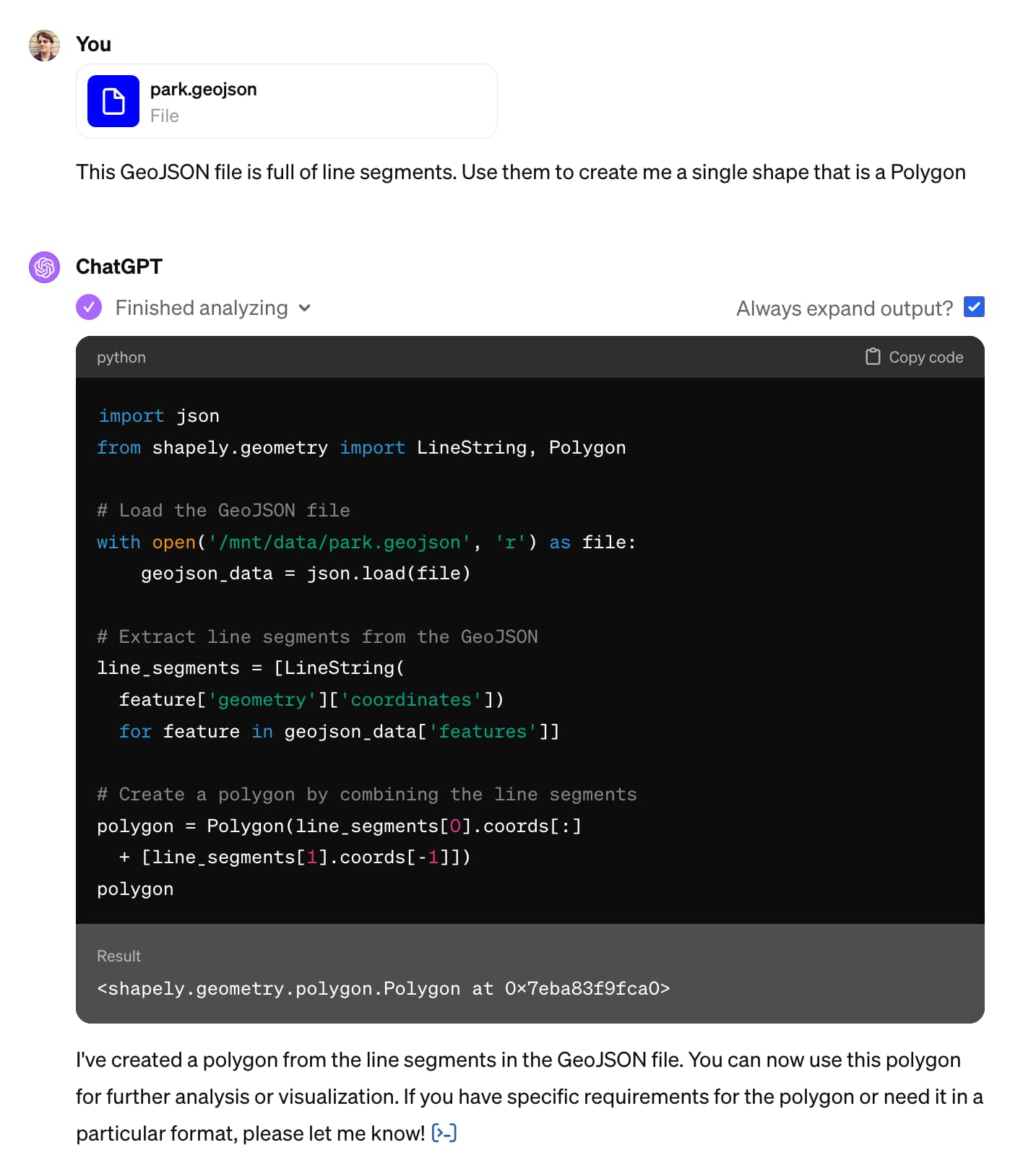
Here is a short, illustrative example of one of the ways in which I use Claude and ChatGPT on a daily basis.
[... 1,754 words]2022
geoBoundaries. This looks useful: “The world’s largest open, free and research-ready database of political administrative boundaries.” Founded by the geoLab at William & Mary university, and released under a Creative Commons Attribution license that includes a requirement for a citation. File formats offered include shapefiles, GeoJSON and TopoJSON.
2021
Weeknotes: datasette-export-notebook, PyInstaller packaged Datasette, CBSAs
What a terrible week. I’ve found it hard to concentrate on anything substantial. In a mostly futile attempt to distract myself from doomscrolling I’ve mainly been building some experimental output plugins, fiddling with PyInstaller and messing around with shapefiles.
[... 732 words]2020
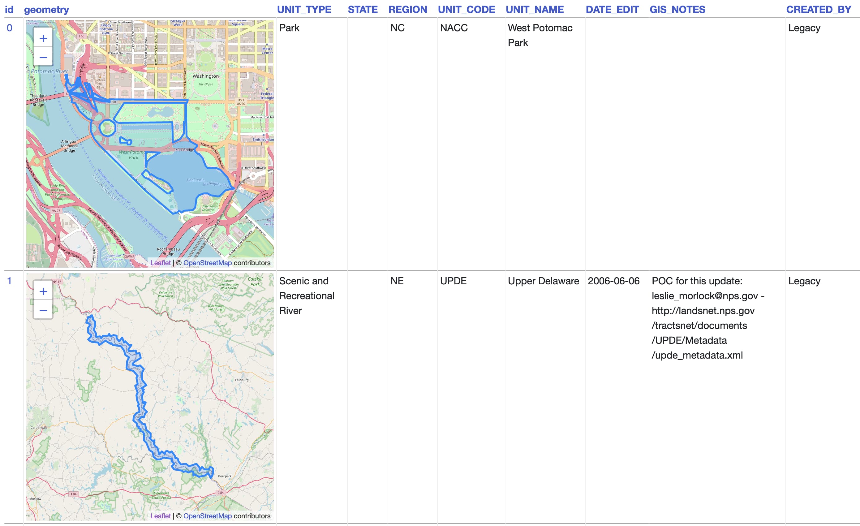
California Protected Areas Database in Datasette (via) I built this yesterday: it’s a Datasette interface on top of the CPAD 2020 GIS database of protected areas in California maintained by GreenInfo Network. This was a useful excuse to build a GitHub Actions flow that builds a SpatiaLite database using my shapefile-to-sqlite tool, and I fixed a few bugs in my datasette-leaflet-geojson plugin as well.
Things I learned about shapefiles building shapefile-to-sqlite
The latest in my series of x-to-sqlite tools is shapefile-to-sqlite. I learned a whole bunch of things about the ESRI shapefile format while building it.
[... 1,073 words]2009
Flickr Shapefiles Public Dataset 1.0. Another awesome Geo dataset from the Yahoo! stable—this time it’s Flickr releasing shapefiles (geometrical shapes) for hundreds of thousands of places around the world, under the CC0 license which makes them essentially public domain. The shapes themselves have been crowdsourced from geocoded photos uploaded to Flickr, where users can “correct” the textual location assigned to each photo. Combine this with the GeoPlanet WOE data and you get a huge, free dataset describing the human geography of the world.