Posts tagged datasette, gis
Filters: datasette × gis × Sorted by date
Visualizing local election results with Datasette, Observable and MapLibre GL
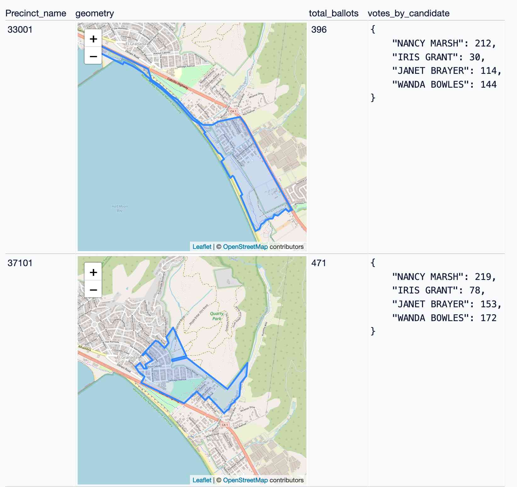
Alex Garcia and myself hosted the first Datasette Open Office Hours on Friday—a live-streamed video session where we hacked on a project together and took questions and tips from community members on Discord.
[... 3,390 words]Geospatial SQL queries in SQLite using TG, sqlite-tg and datasette-sqlite-tg. Alex Garcia built sqlite-tg—a SQLite extension that uses the brand new TG geospatial library to provide a whole suite of custom SQL functions for working with geospatial data.
Here are my notes on trying out his initial alpha releases. The extension already provides tools for converting between GeoJSON, WKT and WKB, plus the all important tg_intersects() function for testing if a polygon or point overlap each other.
It’s pretty useful already. Without any geospatial indexing at all I was still able to get 700ms replies to a brute-force point-in-polygon query against 150MB of GeoJSON timezone boundaries stored as JSON text in a table.
Datasette for geospatial analysis (via) I added a new page to the Datasette website describing how Datasette can be used for geospatial analysis, pulling together several of the relevant plugins and tools from the Datasette ecosystem.
Weeknotes: datasette-tiddlywiki, filters_from_request
I made some good progress on the big refactor this week, including extracting some core logic out into a new Datasette plugin hook. I also got distracted by TiddlyWiki and released a new Datasette plugin that lets you run TiddlyWiki inside Datasette.
[... 1,197 words]Serving map tiles from SQLite with MBTiles and datasette-tiles
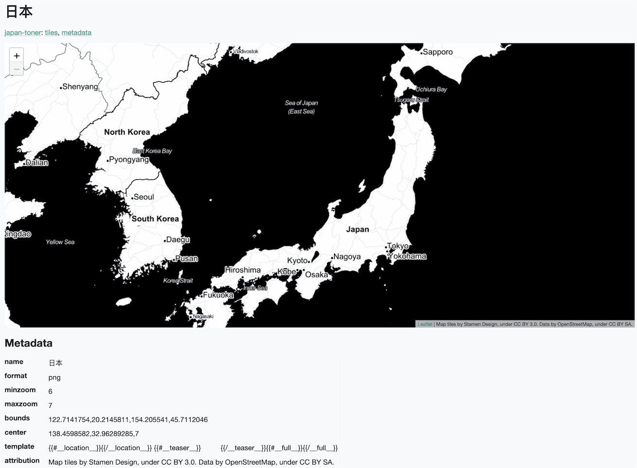
Working on datasette-leaflet last week re-kindled my interest in using Datasette as a GIS (Geographic Information System) platform. SQLite already has strong GIS functionality in the form of SpatiaLite and datasette-cluster-map is currently the most downloaded plugin. Most importantly, maps are fun!
[... 1,334 words]Drawing shapes on a map to query a SpatiaLite database (and other weeknotes)
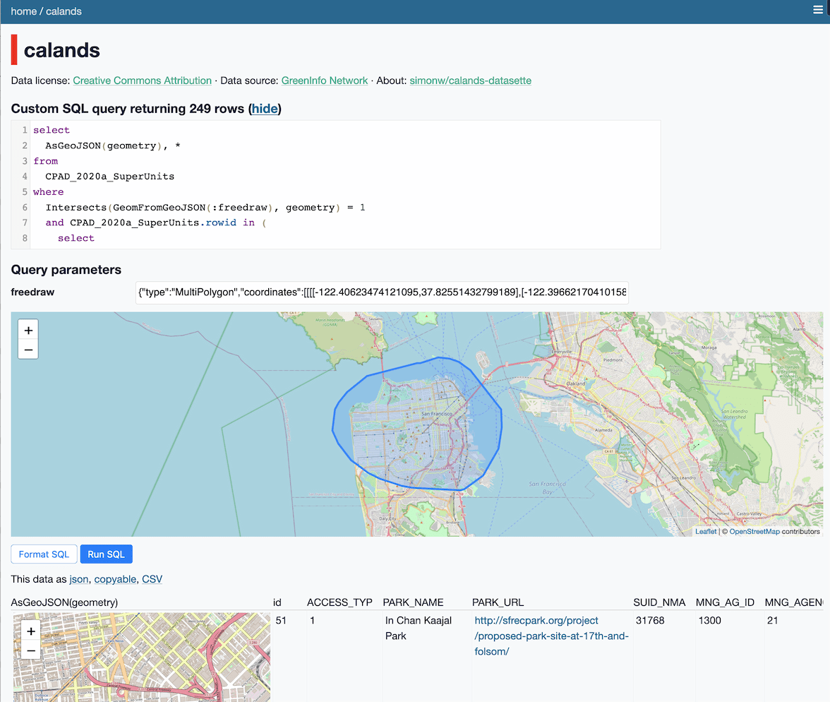
This week I built a Datasette plugin that lets you query a database by drawing shapes on a map!
[... 950 words]Weeknotes: datasette-export-notebook, PyInstaller packaged Datasette, CBSAs
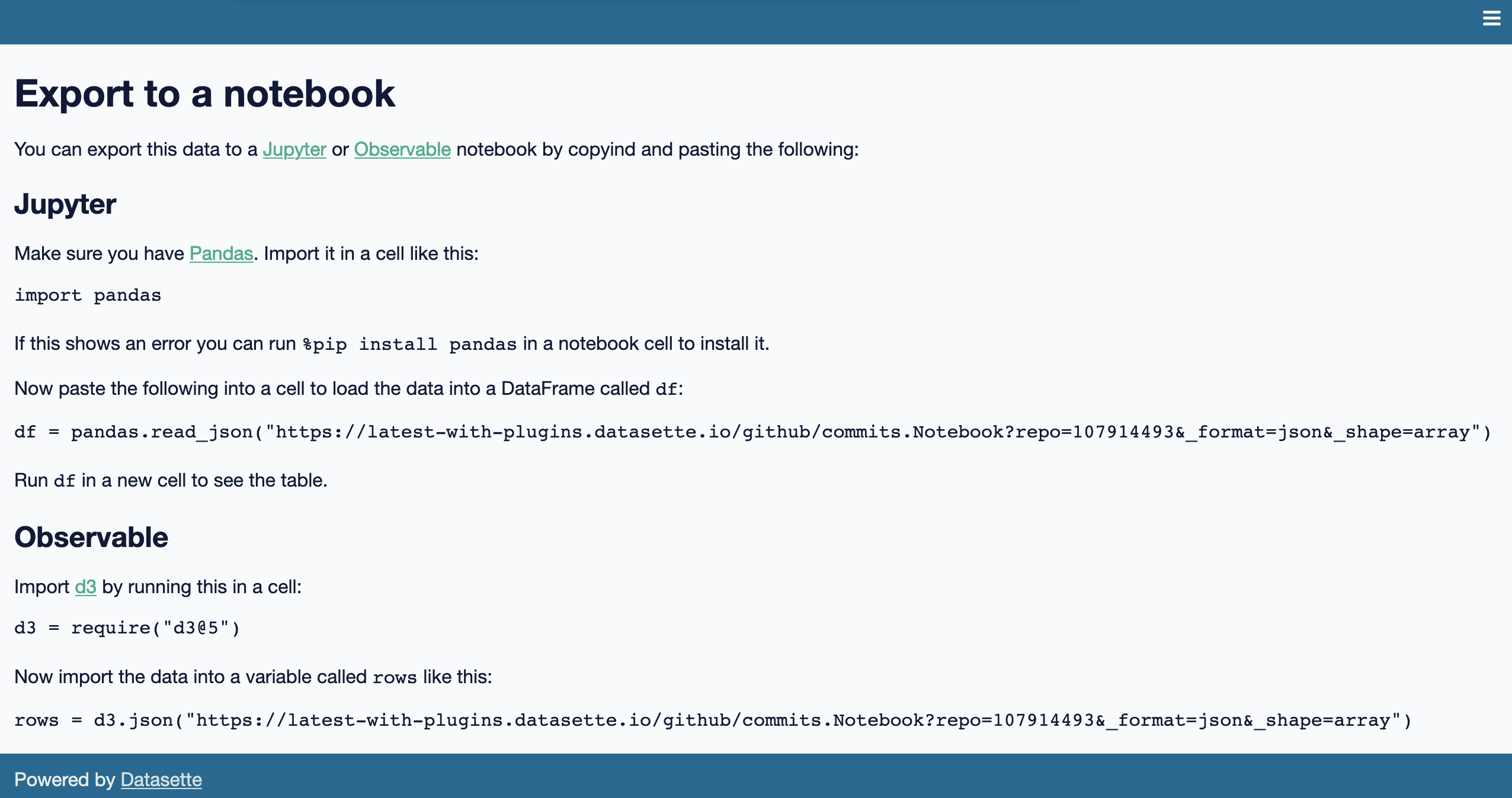
What a terrible week. I’ve found it hard to concentrate on anything substantial. In a mostly futile attempt to distract myself from doomscrolling I’ve mainly been building some experimental output plugins, fiddling with PyInstaller and messing around with shapefiles.
[... 732 words]Weeknotes: California Protected Areas in Datasette
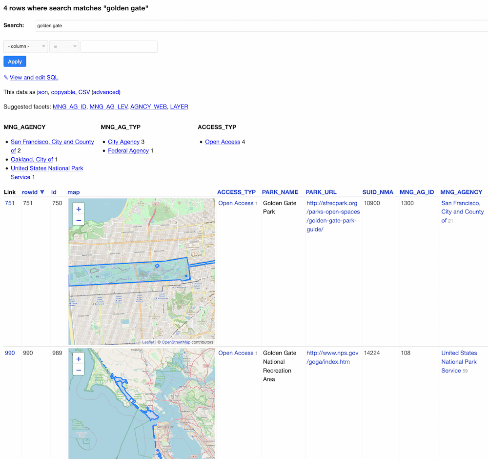
This week I built a geospatial search engine for protected areas in California, shipped datasette-graphql 1.0 and started working towards the next milestone for Datasette Cloud.
[... 1,099 words]California Protected Areas Database in Datasette (via) I built this yesterday: it’s a Datasette interface on top of the CPAD 2020 GIS database of protected areas in California maintained by GreenInfo Network. This was a useful excuse to build a GitHub Actions flow that builds a SpatiaLite database using my shapefile-to-sqlite tool, and I fixed a few bugs in my datasette-leaflet-geojson plugin as well.