15 items tagged “michal-migurski”
2024
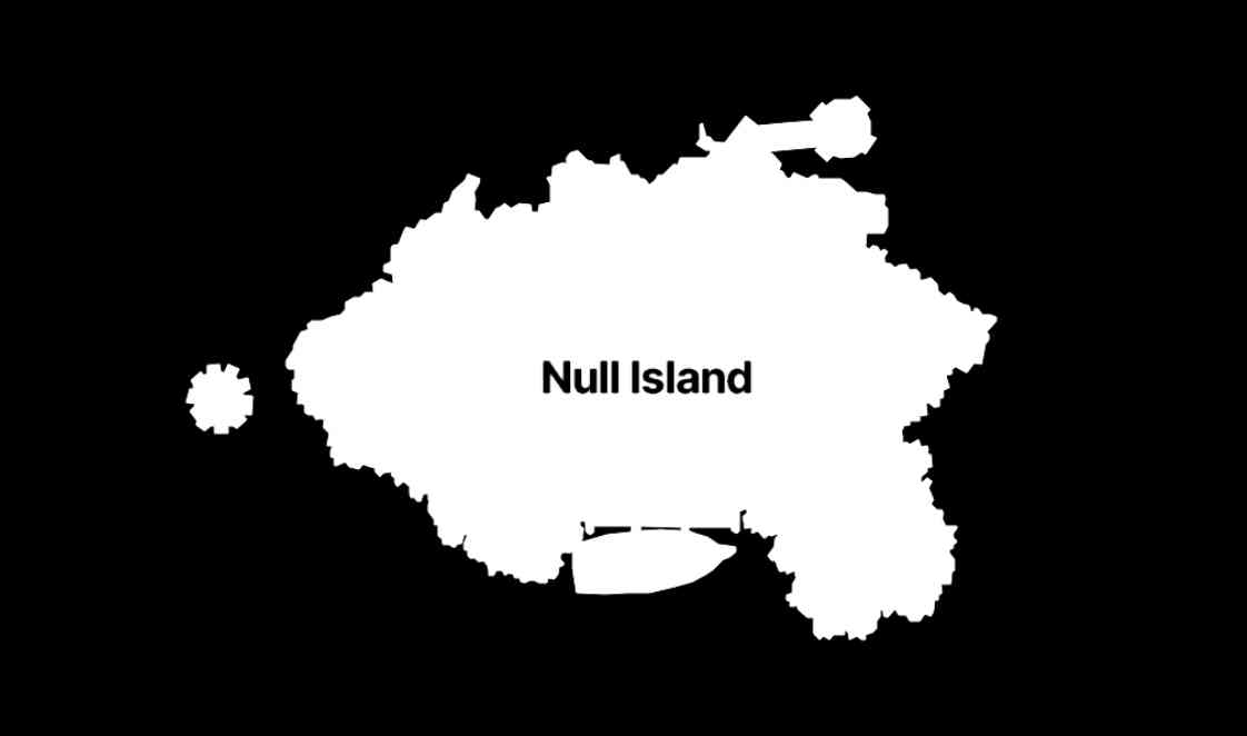
The many lives of Null Island (via) Stamen's custom basemaps have long harbored an Easter egg: zoom all the way in on 0, 0 to see the outline of the mystical "null island", the place where GIS glitches and data bugs accumulate, in the Gulf of Guinea south of Ghana.
Stamen's Alan McConchie provides a detailed history of the Easter egg - first introduced by Mike Migurski in 2010 - along with a definitive guide to the GIS jokes and traditions that surround it.
Here's Null Island on Stamen's Toner map. The shape (also available as GeoJSON) is an homage to the island from 1993's Myst, hence the outline of a large docked ship at the bottom.
Alan recently gave a talk about Stamen's updated custom maps at State of the Map US 2024 (video, slides) - their Toner and Terrain maps are now available as vector tiles served by Stadia Maps (here's the announcement), but their iconic watercolor style is yet to be updated to vectors, due to the weird array of raster tricks it used to achieve the effect.
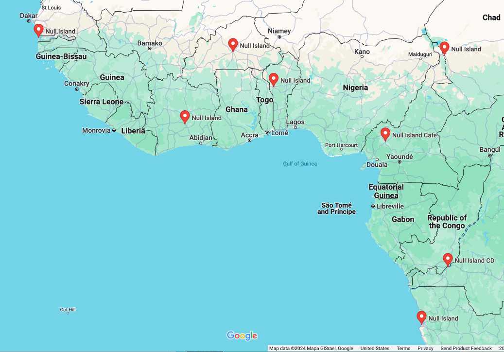
In researching this post I searched for null island on Google Maps and was delighted to learn that a bunch of entrepreneurs in Western Africa have tapped into the meme for their own businesses:
2020
Announcing Daylight Map Distribution. Mike Migurski announces a new distribution of OpenStreetMap: a 42GB dump of the version of the data used by Facebook, carefully moderated to minimize the chance of incorrect or maliciously offensive edits. Lots of constructive conversation in the comments about the best way for Facebook to make their moderation decisions more available to the OSM community.
2010
We've got a rule of thumb inside Stamen that issue names must read like imperatives: "improve variable names", "delete blah functionality", "fix broken jimmy-jammers", etc. Nothing focuses the mind of the reporter like being asked to specify what exactly they'd like to see done, and it's much easier for a developer to scan a list with actual tasks right in the sentence construction.
2009
breaking links. Mike complains about sites such as Twitter and WordPress.com which mess around with Ajax and links and hence breaks the ability to command-click to open a new tab in Safari (and Chrome). I just realised that I’ve subconsciously retrained myself to right click and select “open in new tab” to avoid that exact issue.
openstreetmap genuine advantage. The OpenStreetMap data model (points, ways and relations, all allowing arbitrary key/value tags) is a real thing of beauty—simple to understand but almost infinitely extensible. Mike Migurski’s latest project adds PGP signing to OpenStreetMap, allowing organisations (such as local government) to add a signature to a way (a sequence of points) and a subset of its tags, then write that signature in to a new tag on the object.
Tile Drawer (via) The most inspired use of EC2 I’ve seen yet: center a map on an area, pick a Cascadenik stylesheet URL (or write and link to your own) and Tile Drawer gives you an Amazon EC2 AMI and a short JSON snippet. Launch the AMI with the JSON as the “user data” parameter and you get your own OpenStreetMap tile rendering server, which self-configures on startup and starts rendering and serving tiles using your custom design.
walking papers lives. Round trip mapping: print out a map from OpenStreetMap, walk around annotating it with a pen, then scan the result back in (a QR code ensures the area and orientation is recognised) . Specifically targeted at eye-level stuff which can’t be collected using GPS or aerial imagery alone. When I grow up, I want to be Mike Migurski.
slippy faumaxion, take two. Mike Migurski made a slippy map using triangular tiles, based on the same principle as Buckminster Fuller’s famous Dymaxion World Map.
maps from scratch. An idea whose time has come: using EC2 AMIs for tutorial sessions to give everyone a pre-configured environment.
2008
Oakland crime maps XI: how close, and how bad? Michal Migurski’s experiments with heat maps for Oakland Crimespotting, using OpenStreetMap data as that allows him to position his heat map layer underneath the street labels, keeping them legible.
cascadenik: cascading sheets of style for mapnik. Great idea. Mapnik (the open source tile rendering system used by OpenStreetMap and others) has a complex style configuration based on XML. Michal Migurski has build a CSS-style equivalent which compiles down to XML, hopefully making it much quicker and easier to get started with Mapnik customisation.
2007
gefingerpoken. Michal Migurski shows how to implement the algorithm for two-finger deforming drag using affine transformation matrices in Flash.
Optimizing Web Applications and Content for iPhone (via) Apple’s iPhone developer documentation.
Oakland crime maps VI: public, indexed data. Rather than serve content dynamically for his Oaxland Crime site, Michal Migurski plans to serve up various static indexes and have smart clients use them to quickly navigate the data.
disinfographics. These really are pretty remarkable.