7 posts tagged “overture”
Overture provides interoperable open map data.
2025
Let the LLM Write the Prompts: An Intro to DSPy in Compound Al Pipelines. I've had trouble getting my head around DSPy in the past. This half hour talk by Drew Breunig at the recent Databricks Data + AI Summit is the clearest explanation I've seen yet of the kinds of problems it can help solve.
Here's Drew's written version of the talk.
Drew works on Overture Maps, which combines Point Of Interest data from numerous providers to create a single unified POI database. This is an example of conflation, a notoriously difficult task in GIS where multiple datasets are deduped and merged together.
Drew uses an inexpensive local model, Qwen3-0.6B, to compare 70 million addresses and identity matches, for example between Place(address="3359 FOOTHILL BLVD", name="RESTAURANT LOS ARCOS") and Place(address="3359 FOOTHILL BLVD", name="Los Arcos Taqueria"').
DSPy's role is to optimize the prompt used for that smaller model. Drew used GPT-4.1 and the dspy.MIPROv2 optimizer, producing a 700 token prompt that increased the score from 60.7% to 82%.
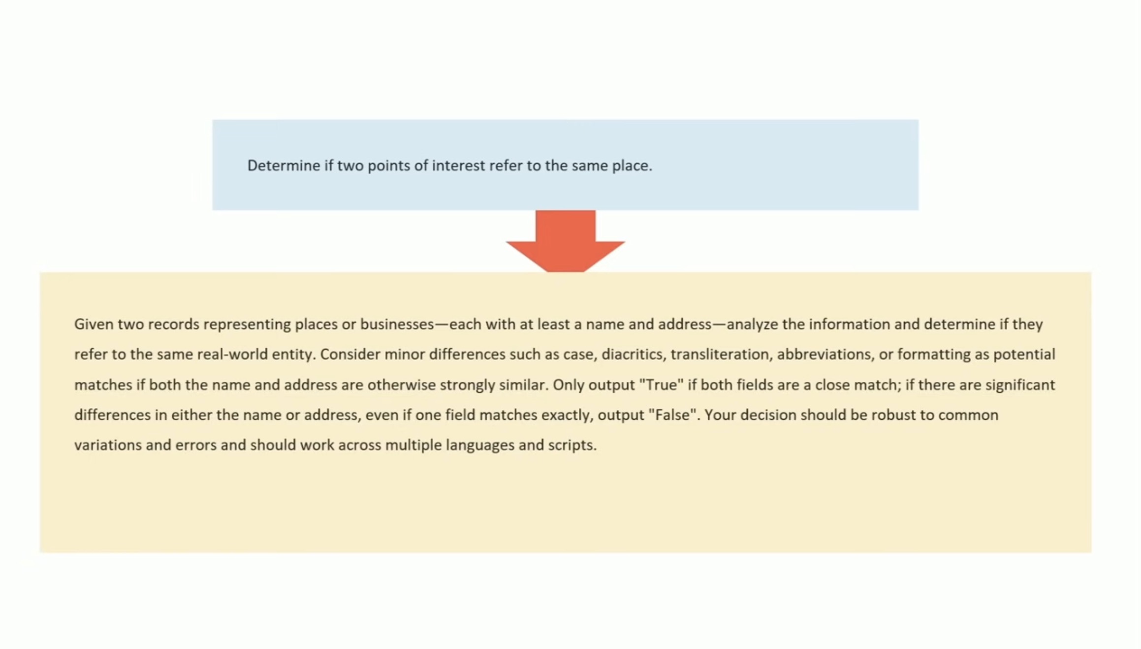
Why bother? Drew points out that having a prompt optimization pipeline makes it trivial to evaluate and switch to other models if they can score higher with a custom optimized prompt - without needing to execute that trial-and-error optimization by hand.
2024
Conflating Overture Places Using DuckDB, Ollama, Embeddings, and More.
Drew Breunig's detailed tutorial on "conflation" - combining different geospatial data sources by de-duplicating address strings such as RESTAURANT LOS ARCOS,3359 FOOTHILL BLVD,OAKLAND,94601 and LOS ARCOS TAQUERIA,3359 FOOTHILL BLVD,OAKLAND,94601.
Drew uses an entirely offline stack based around Python, DuckDB and Ollama and finds that a combination of H3 geospatial tiles and mxbai-embed-large embeddings (though other embedding models should work equally well) gets really good results.
Towards Standardizing Place. Overture Maps announced General Availability of its global maps datasets last week, covering places, buildings, divisions, and base layers.
Drew Breunig demonstrates how this can be accessed using both the Overture Explorer tool and DuckDB, and talks about Overture's GERS IDs - reminiscent of Who's On First IDs - which provide stable IDs for all kinds of geographic places.
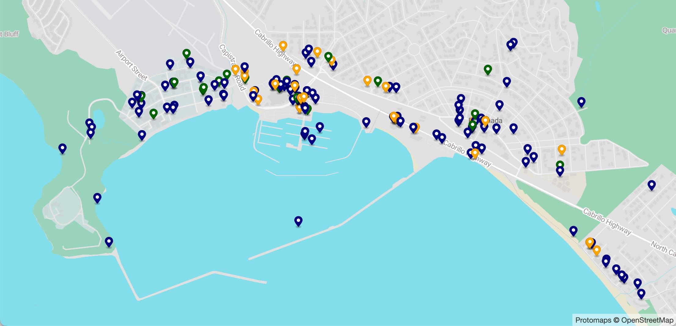
A POI Database in One Line (via) Overture maps offer an extraordinarily useful freely licensed databases of POI (point of interest) listings, principally derived from partners such as Facebook and including restaurants, shops, museums and other locations from all around the world.
Their new "overturemaps" Python CLI utility makes it easy to quickly pull subsets of their data... but requires you to provide a bounding box to do so.
Drew Breunig came up with this delightful recipe for fetching data using LLM and gpt-3.5-turbo to fill in those bounding boxes:
overturemaps download --bbox=$(llm 'Give me a bounding box for Alameda, California expressed as only four numbers delineated by commas, with no spaces, longitude preceding latitude.') -f geojsonseq --type=place | geojson-to-sqlite alameda.db places - --nl --pk=id
How to make self-hosted maps that work everywhere and cost next to nothing. Chris Amico provides a detailed roundup of the state of web mapping in 2024. It’s never been easier to entirely host your own mapping infrastructure, thanks to OpenStreetMap, Overture, MBTiles, PMTiles, Maplibre and a whole ecosystem of other fine open source projects.
I like Protomaps creator Brandon Liu’s description of this: “post-scarcity web mapping”.
2023
DALL-E 3, GPT4All, PMTiles, sqlite-migrate, datasette-edit-schema
I wrote a lot this week. I also did some fun research into new options for self-hosting vector maps and pushed out several new releases of plugins.
[... 1,362 words]Overture Maps Foundation Releases Its First World-Wide Open Map Dataset. The Overture Maps Foundation is a collaboration lead by Amazon, Meta, Microsoft and TomTom dedicated to producing “reliable, easy-to-use, and interoperable open map data”.
Yesterday they put out their first release and it’s pretty astonishing: four different layers of geodata, covering Places of Interest (shops, restaurants, attractions etc), administrative boundaries, building outlines and transportation networks.
The data is available as Parquet. I just downloaded the 8GB places dataset and can confirm that it contains 59 million listings from around the world—I filtered to just places in my local town and a spot check showed that recently opened businesses (last 12 months) were present and the details all looked accurate.
The places data is licensed under “Community Data License Agreement – Permissive” which looks like the only restriction is that you have to include that license when you further share the data.