Elsewhere
Release TIL Research Tool Museum
Filters: Sorted by date
3,116 results
«« first
« previous
page 71 / 104
next »
last »»
TIL
Enabling a gin index for faster LIKE queries
— I tried using a gin index to speed up `LIKE '%term%'` queries against a column.

TIL
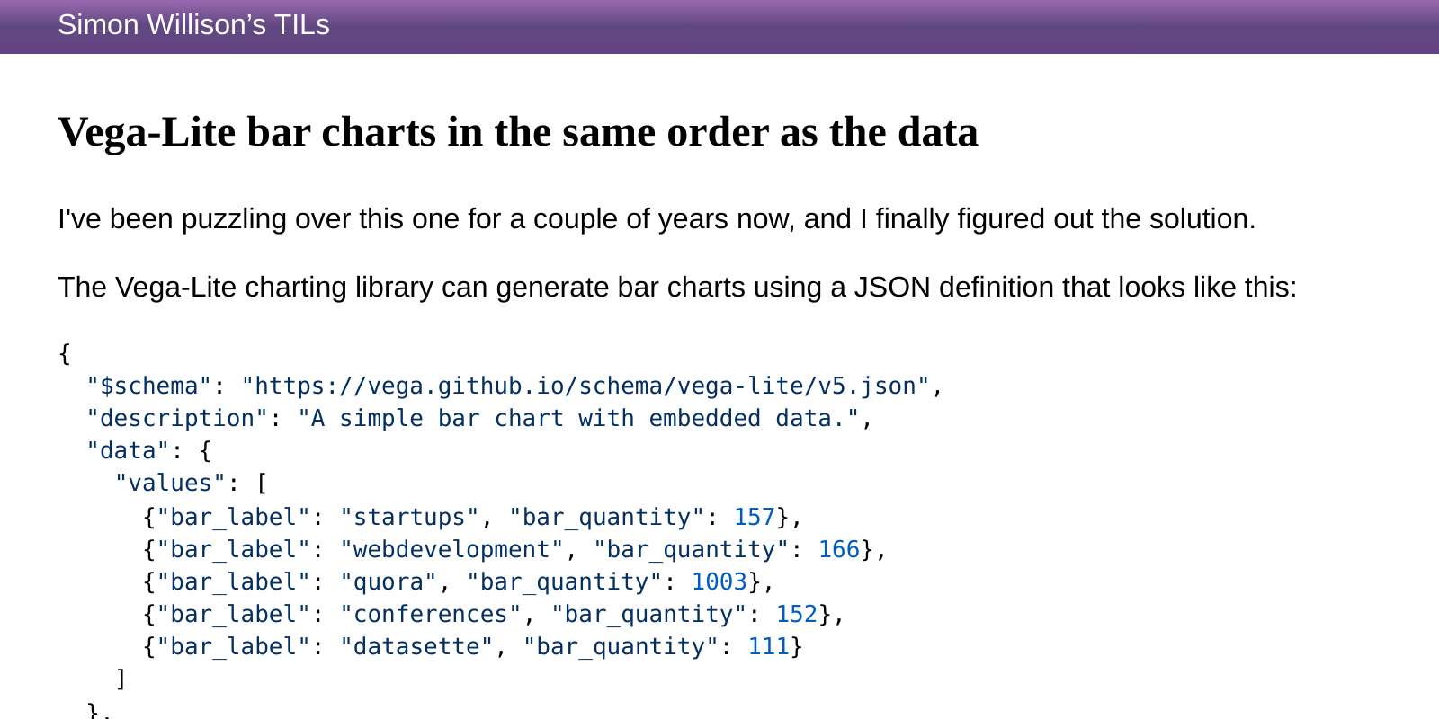
Vega-Lite bar charts in the same order as the data
— I've been puzzling over this one for a couple of years now, and I finally figured out the solution.
TIL
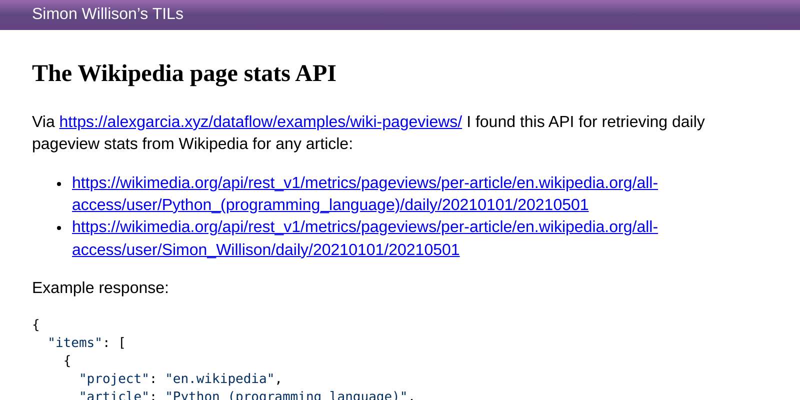
The Wikipedia page stats API
— Via https://alexgarcia.xyz/dataflow/examples/wiki-pageviews/ I found this API for retrieving daily pageview stats from Wikipedia for any article:
TIL
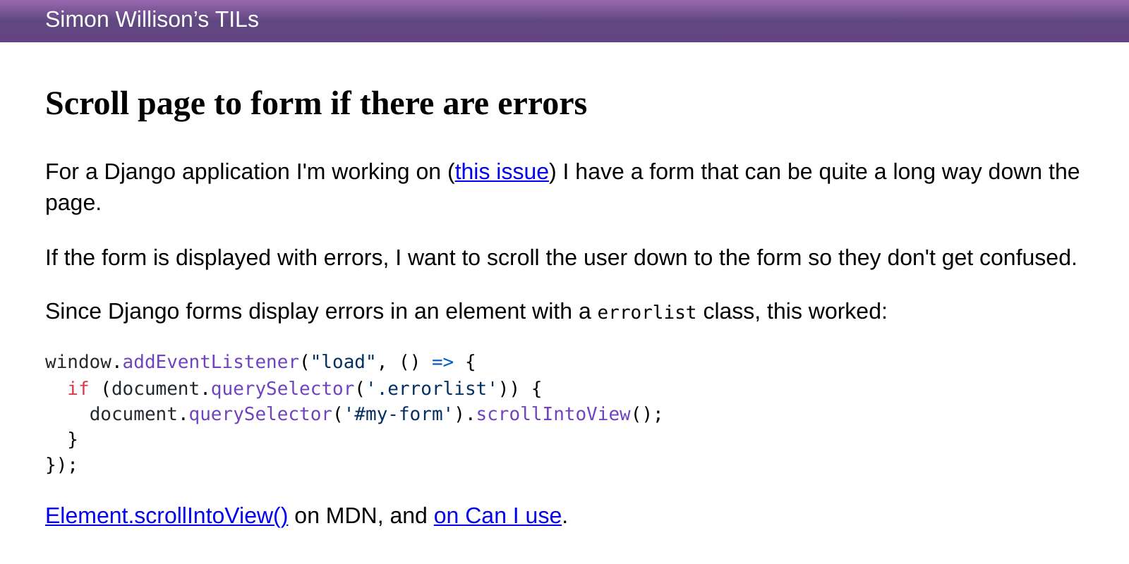
Scroll page to form if there are errors
— For a Django application I'm working on ([this issue](https://github.com/simonw/django-sql-dashboard/issues/44)) I have a form that can be quite a long way down the page.

TIL
migrations.RunSQL.noop for reversible SQL migrations
— `migrations.RunSQL.noop` provides an easy way to create "reversible" Django SQL migrations, where the reverse operation does nothing (but keeps it possible to reverse back to a previous migration state without being blocked by an irreversible migration).

TIL
Django Admin action for exporting selected rows as CSV
— I wanted to add an action option to the Django Admin for exporting the currently selected set of rows (or every row in the table) as a CSV file.

TIL
Constructing GeoJSON in PostgreSQL
— In order to efficiently generate a GeoJSON representation of a vast number of locations, I'm currently experimenting with generating the GeoJSON directly inside a PostgreSQL SQL query using `json_build_object()` and friends.

TIL
Filter by comma-separated values in the Django admin
— I have a text column which contains comma-separated values - inherited from an older database schema.

TIL
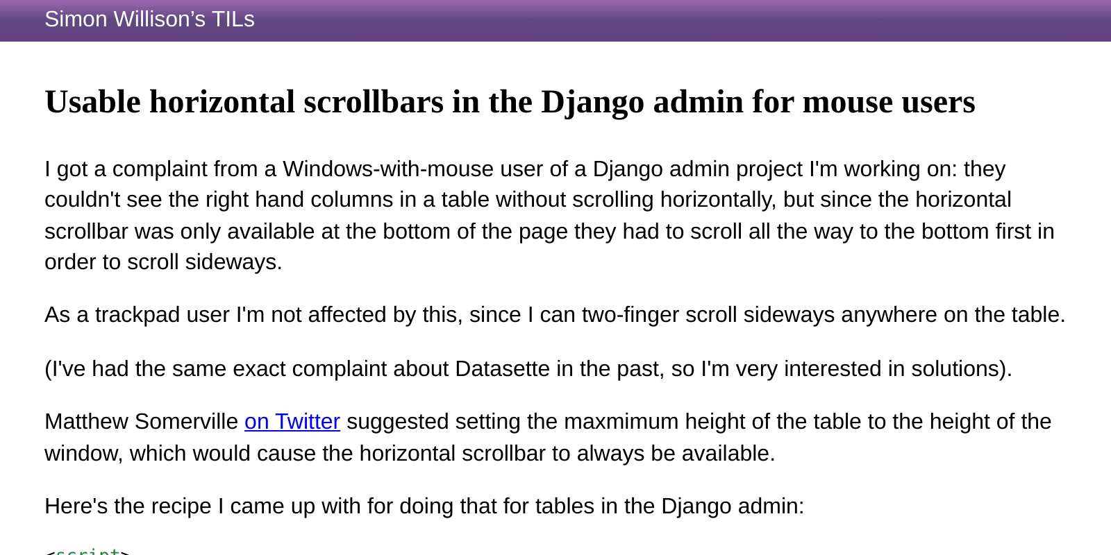
Usable horizontal scrollbars in the Django admin for mouse users
— I got a complaint from a Windows-with-mouse user of a Django admin project I'm working on: they couldn't see the right hand columns in a table without scrolling horizontally, but since the horizontal scrollbar was only available at the bottom of the page they had to scroll all the way to the bottom first in order to scroll sideways.
TIL
Enabling the fuzzystrmatch extension in PostgreSQL with a Django migration
— The PostgreSQL [fuzzystrmatch extension](https://www.postgresql.org/docs/13/fuzzystrmatch.html) enables several functions for fuzzy string matching: `soundex()`, `difference()`, `levenshtein()`, `levenshtein_less_equal()`, `metaphone()`, `dmetaphone()` and `dmetaphone_alt()`.

TIL
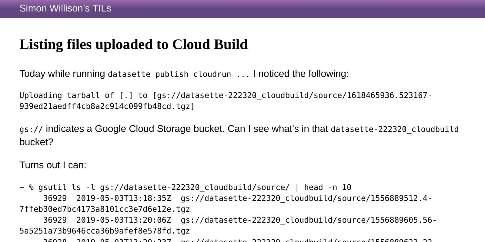
Listing files uploaded to Cloud Build
— Today while running `datasette publish cloudrun ...` I noticed the following:
TIL
Using json_extract_path in PostgreSQL
— The `json_extract_path()` function in PostgreSQL can be used to extract specific items from JSON - but I couldn't find documentation for the path language it uses.

«« first
« previous
page 71 / 104
next »
last »»