4 posts tagged “stamen-design”
2024
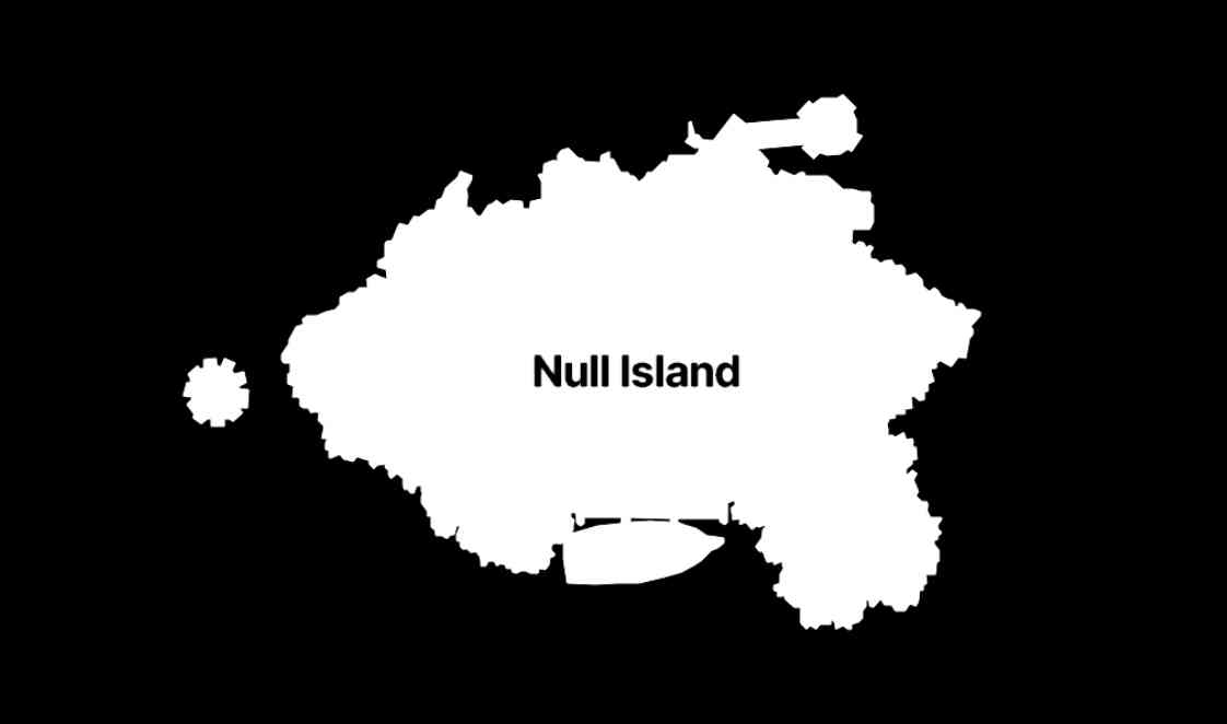
The many lives of Null Island (via) Stamen's custom basemaps have long harbored an Easter egg: zoom all the way in on 0, 0 to see the outline of the mystical "null island", the place where GIS glitches and data bugs accumulate, in the Gulf of Guinea south of Ghana.
Stamen's Alan McConchie provides a detailed history of the Easter egg - first introduced by Mike Migurski in 2010 - along with a definitive guide to the GIS jokes and traditions that surround it.
Here's Null Island on Stamen's Toner map. The shape (also available as GeoJSON) is an homage to the island from 1993's Myst, hence the outline of a large docked ship at the bottom.
Alan recently gave a talk about Stamen's updated custom maps at State of the Map US 2024 (video, slides) - their Toner and Terrain maps are now available as vector tiles served by Stadia Maps (here's the announcement), but their iconic watercolor style is yet to be updated to vectors, due to the weird array of raster tricks it used to achieve the effect.
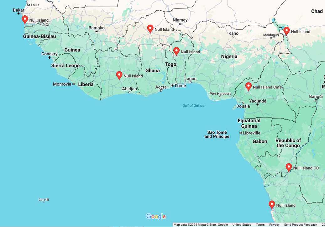
In researching this post I searched for null island on Google Maps and was delighted to learn that a bunch of entrepreneurs in Western Africa have tapped into the meme for their own businesses:
2010
Polymaps. Absurdly classy: “a JavaScript library for image- and vector-tiled maps using SVG”. It can pull in image tiles from sources such as OpenStreetMap, then overlay SVG paths specified using GeoJSON. The demos make use of GeoJSON tiles for US states and counties hosted on AppEngine. The library is developed by Stamen and SimpleGeo, and released under a BSD license. SVG support in the browser is required.
We've got a rule of thumb inside Stamen that issue names must read like imperatives: "improve variable names", "delete blah functionality", "fix broken jimmy-jammers", etc. Nothing focuses the mind of the reporter like being asked to specify what exactly they'd like to see done, and it's much easier for a developer to scan a list with actual tasks right in the sentence construction.
2008
Dynamic Time-Travel Maps. Absolutely beautiful dynamic implementation of Chris Lightfoot’s Time Travel project, put together by Stamen Design and MySociety. Drag sliders to specify your preferred commute and housing budget to see where in London you can live.