Items tagged geospatial, maps
Filters: geospatial × maps × Sorted by date
OpenFreeMap (via) New free map tile hosting service from Zsolt Ero:
OpenFreeMap lets you display custom maps on your website and apps for free. […] Using our public instance is completely free: there are no limits on the number of map views or requests. There’s no registration, no user database, no API keys, and no cookies. We aim to cover the running costs of our public instance through donations.
The site serves static vector tiles that work with MapLibre GL. It deliberately doesn’t offer any other services such as search or routing.
From the project README looks like it’s hosted on two Hetzner machines. I don’t think the public server is behind a CDN.
Part of the trick to serving the tiles efficiently is the way it takes advantage of Btrfs:
Production-quality hosting of 300 million tiny files is hard. The average file size is just 450 byte. Dozens of tile servers have been written to tackle this problem, but they all have their limitations.
The original idea of this project is to avoid using tile servers altogether. Instead, the tiles are directly served from Btrfs partition images + hard links using an optimised nginx config.
The self-hosting guide describes the scripts that are provided for downloading their pre-built tiles (needing a fresh Ubuntu server with 300GB of SSD and 4GB of RAM) or building the tiles yourself using Planetiler (needs 500GB of disk and 64GB of RAM).
Getting started is delightfully straightforward:
const map = new maplibregl.Map({
  style: 'https://tiles.openfreemap.org/styles/liberty',
  center: [13.388, 52.517],
  zoom: 9.5,
  container: 'map',
})
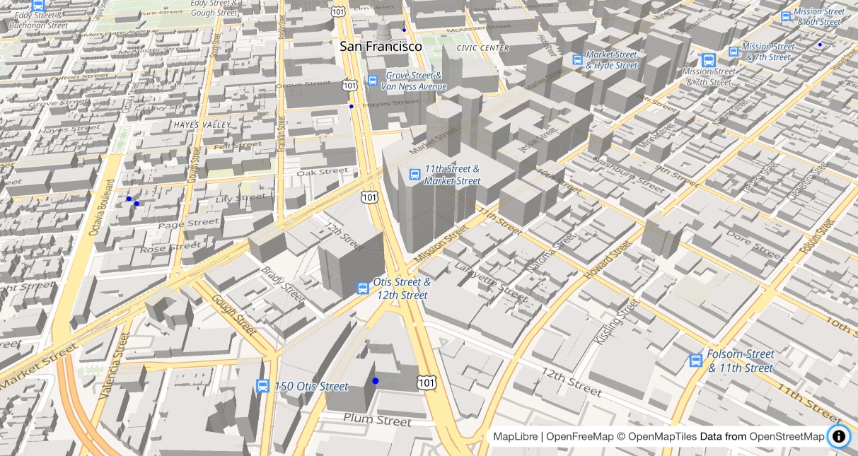
I got Claude to help build this demo showing a thousand random markers dotted around San Francisco. The 3D tiles even include building shapes!

Zsolt built OpenFreeMap based on his experience running MapHub over the last 9 years. Here’s a 2018 interview about that project.
It’s pretty incredible that the OpenStreetMap and open geospatial stack has evolved to the point now where it’s economically feasible for an individual to offer a service like this. I hope this turns out to be sustainable. Hetzner charge just €1 per TB for bandwidth (S3 can cost $90/TB) which should help a lot.
Flickr Shapefiles Public Dataset 1.0. Another awesome Geo dataset from the Yahoo! stable—this time it’s Flickr releasing shapefiles (geometrical shapes) for hundreds of thousands of places around the world, under the CC0 license which makes them essentially public domain. The shapes themselves have been crowdsourced from geocoded photos uploaded to Flickr, where users can “correct” the textual location assigned to each photo. Combine this with the GeoPlanet WOE data and you get a huge, free dataset describing the human geography of the world.