Posts tagged gis in Jul
Filters: Month: Jul × gis × Sorted by date
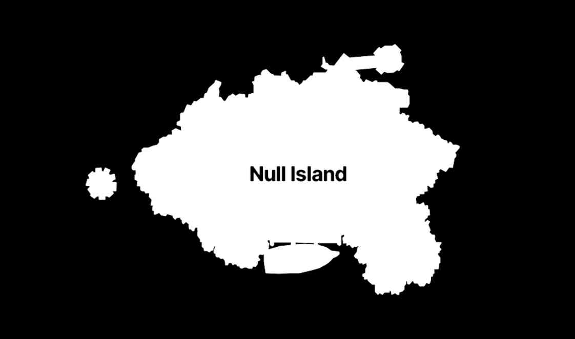
The many lives of Null Island (via) Stamen's custom basemaps have long harbored an Easter egg: zoom all the way in on 0, 0 to see the outline of the mystical "null island", the place where GIS glitches and data bugs accumulate, in the Gulf of Guinea south of Ghana.
Stamen's Alan McConchie provides a detailed history of the Easter egg - first introduced by Mike Migurski in 2010 - along with a definitive guide to the GIS jokes and traditions that surround it.
Here's Null Island on Stamen's Toner map. The shape (also available as GeoJSON) is an homage to the island from 1993's Myst, hence the outline of a large docked ship at the bottom.
Alan recently gave a talk about Stamen's updated custom maps at State of the Map US 2024 (video, slides) - their Toner and Terrain maps are now available as vector tiles served by Stadia Maps (here's the announcement), but their iconic watercolor style is yet to be updated to vectors, due to the weird array of raster tricks it used to achieve the effect.
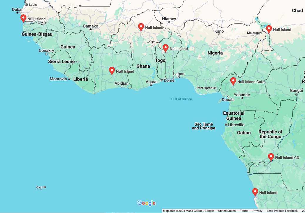
In researching this post I searched for null island on Google Maps and was delighted to learn that a bunch of entrepreneurs in Western Africa have tapped into the meme for their own businesses:
Searching an aerial photo with text queries. Robin Wilson built a demo that lets you search a large aerial photograph of Southampton for things like "roundabout" or "tennis court". He explains how it works in detail: he used the SkyCLIP model, which is trained on "5.2 million remote sensing image-text pairs in total, covering more than 29K distinct semantic tags" to generate embeddings for 200x200 image segments (with 100px of overlap), then stored them in Pinecone.
Overture Maps Foundation Releases Its First World-Wide Open Map Dataset. The Overture Maps Foundation is a collaboration lead by Amazon, Meta, Microsoft and TomTom dedicated to producing “reliable, easy-to-use, and interoperable open map data”.
Yesterday they put out their first release and it’s pretty astonishing: four different layers of geodata, covering Places of Interest (shops, restaurants, attractions etc), administrative boundaries, building outlines and transportation networks.
The data is available as Parquet. I just downloaded the 8GB places dataset and can confirm that it contains 59 million listings from around the world—I filtered to just places in my local town and a spot check showed that recently opened businesses (last 12 months) were present and the details all looked accurate.
The places data is licensed under “Community Data License Agreement – Permissive” which looks like the only restriction is that you have to include that license when you further share the data.
GPSJam (via) John Wiseman’s “Daily maps of GPS interference” —a beautiful interactive globe (powered by Mapbox GL) which you can use to see points of heaviest GPS interference over a 24 hour period, using data collected from commercial airline radios by ADS-B Exchange. “From what I can tell the most common reason for aircraft GPS systems to have degraded accuracy is jamming by military systems. At least, the vast majority of aircraft that I see with bad GPS accuracy are flying near conflict zones where GPS jamming is known to occur.”
EveryBlock source code released. EveryBlock’s Knight Foundation grant required them to release the source code after two years, under the GPL. Lots of neat Django / PostgreSQL / GIS tricks to be found within.