Sunday, 9th March 2025
wolf-h3-viewer.glitch.me (via) Neat interactive visualization of Uber's H3 hexagonal geographical indexing mechanism.
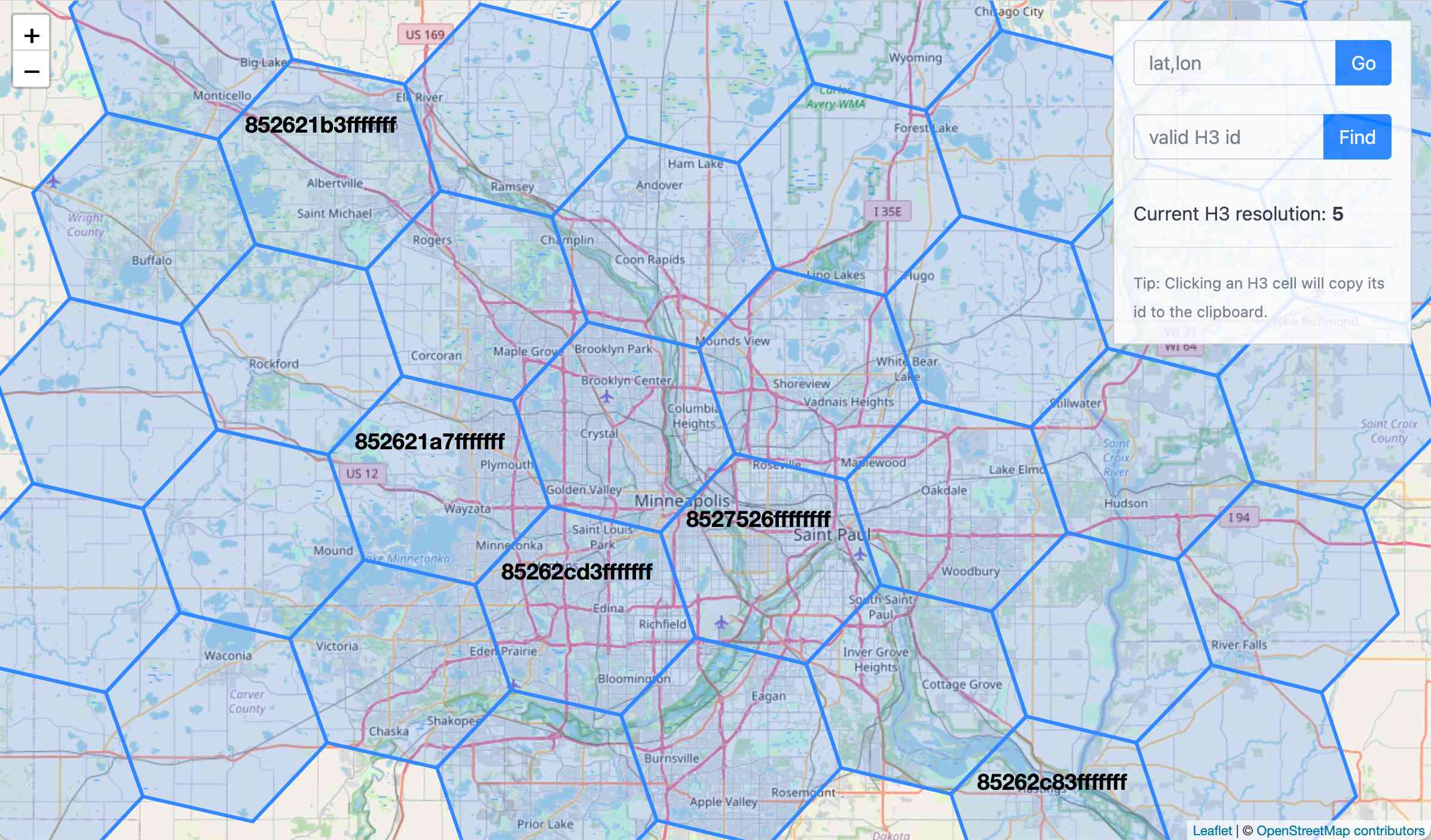
Here's the source code.
Why does H3 use hexagons? Because Hexagons are the Bestagons:
When hexagons come together, they form three-sided joints 120 degrees apart. This, for the least material, is the most mechanically stable arrangement.
Only triangles, squares, and hexagons can tile a plane without gaps, and of those three shapes hexagons offer the best ratio of perimeter to area.
I've been using Claude Code for a couple of days, and it has been absolutely ruthless in chewing through legacy bugs in my gnarly old code base. It's like a wood chipper fueled by dollars. It can power through shockingly impressive tasks, using nothing but chat. [...]
Claude Code's form factor is clunky as hell, it has no multimodal support, and it's hard to juggle with other tools. But it doesn't matter. It might look antiquated but it makes Cursor, Windsurf, Augment and the rest of the lot (yeah, ours too, and Copilot, let's be honest) FEEL antiquated.
— Steve Yegge, who works on Cody at Sourcegraph